
Rattlesnake Creek Restoration and Adaptive Management Plan
On April 13, 2017, a private earthen dam failed, contributing to a significant flood on Rattlesnake Creek in the lower Grande Ronde River subbasin in southeastern Washington. Subsequent reconnaissance revealed significant impacts to habitat, water quality, and infrastructure along the entirety of the 6.5-mile stream corridor that is occupied by Endangered Species Act (ESA)-listed steelhead trout. The owner of the dam and the Washington State Department of Ecology (Ecology) signed an Agreed Order mandating certain prioritized actions occur over a 3-year implementation period and 10-year monitoring period to restore fish passage, habitat, and water quality.
Rio ASE, working for the private landowner and in close coordination with Ecology and several other partners, is managing the restoration planning, design, and implementation for the entire project. Detailed LiDAR topography was flown and geomorphic, habitat, and vegetation surveys were conducted to evaluate post-flood conditions, identify fish passage barriers, and inform the restoration design. Over the next several months, Rio ASE developed a detailed and comprehensive restoration plan and design for all 6.5 miles of stream and floodplain impacted. Rio ASE also coordinated and negotiated all restoration plan details with 11 affected landowners, several regulatory agencies, lawyers, and insurance companies. Rio ASE completed all necessary permits, including cultural resources consultation (with help from Plateau Archaeology), riparian revegetation plans (with help from Wildlands, Inc.), and ESA consultation.
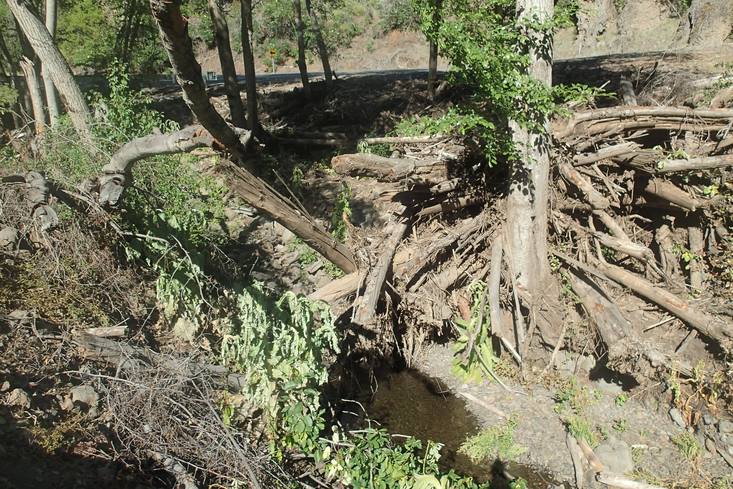
Flood debris stacked 20 feet above the active channel. The force of the flood removed all vegetation and mobilized boulder-sized sediments over a roughly 100-foot-wide swath for 6.5 miles. Restoration includes earthwork and salvaging flood debris to rebuild the channel and create habitat.

One year after dam-breach flood, 6+ feet of boulder deposition completely obscures the original channel and floodplain and creates a fish passage barrier.